The overarching goal of the CASPIAN project is to advance real-time coastal flood prediction by providing high-precision inundation mapping across diverse coastal regions under varying sea-level rise scenarios, supporting climate resilience and effective disaster management.
Coastal communities are increasingly threatened by the impacts of climate change, including rising sea levels and more frequent extreme weather events. Accurate and timely flood prediction is critical for safeguarding lives, infrastructure, and ecosystems. However, traditional and simulation-based flood modeling methods are often computationally intensive, slow, and unable to provide real-time predictions, making them unsuitable for emergency response and rapid decision-making. Additionally, existing methods struggle to generalize across diverse coastal regions and adapt to varying sea-level rise (SLR) scenarios.
CASPIAN project is developed to overcome these limitations by leveraging advanced deep learning techniques for high-precision, real-time flood inundation prediction. By integrating SLR data and shoreline adaptation measures, our framework delivers scalable and robust flood risk assessments across diverse coastal environments. This enables faster, data-driven decision-making for policymakers, urban planners, and emergency response teams, supporting proactive climate resilience and effective disaster management.
This project bridges the gap between traditional simulation models and adaptive AI-driven solutions, providing a critical tool for protecting vulnerable coastal regions in the face of accelerating climate change.

The CASPIAN dataset is the first of its kind for coastal flood inundation prediction. The dataset is generated using a high-fidelity hydrodynamic simulator to accurately model coastal flooding under diverse environmental scenarios.
We provide data from San Francisco, USA, and Abu Dhabi, UAE—two contrasting coastal environments with distinct geographical and shoreline characteristics, providing a comprehensive basis for flood risk analysis.
The dataset integrates various shoreline adaptation strategies, simulating both protected and unprotected coastal scenarios to comprehensively assess flood impacts under different coastal defense and mitigation measures.
The dataset covers coastal flooding across multiple SLR projections, including 0.5m, 1.0m, and 1.5m scenarios, enabling comprehensive evaluation of flood risks under varying climate change impacts and future sea-level conditions.
All data in CASPIAN project is generated using a hydrodynamic simulator and processed into high-resolution 1024×1024 grid formats, making it directly compatible with deep learning models for flood prediction and analysis.
The proposed CASPIAN-v2 model, along with other trained models, serves as a benchmark for advancing coastal flood prediction and supporting scalable AI solutions for climate resilience and disaster management.
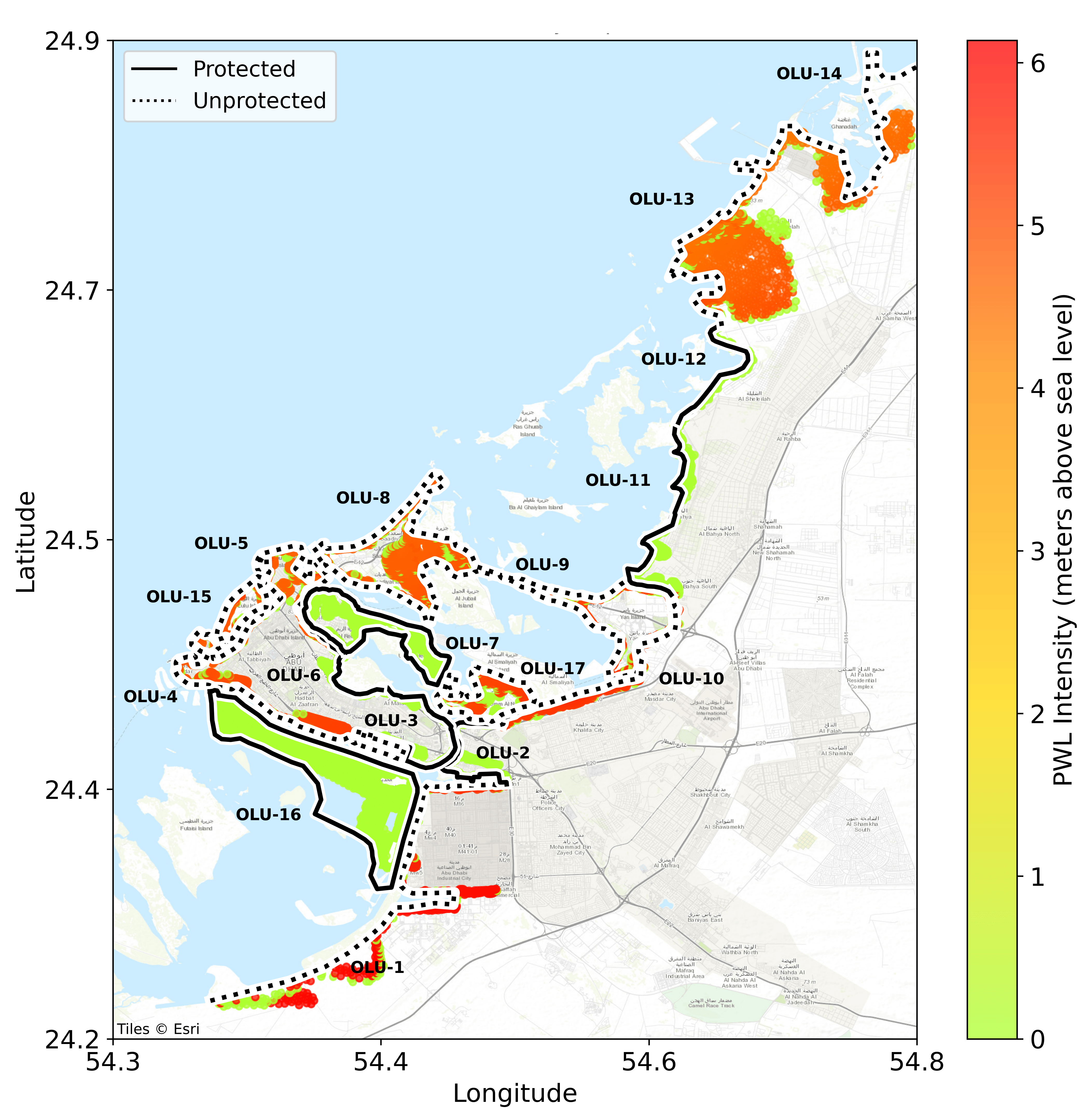
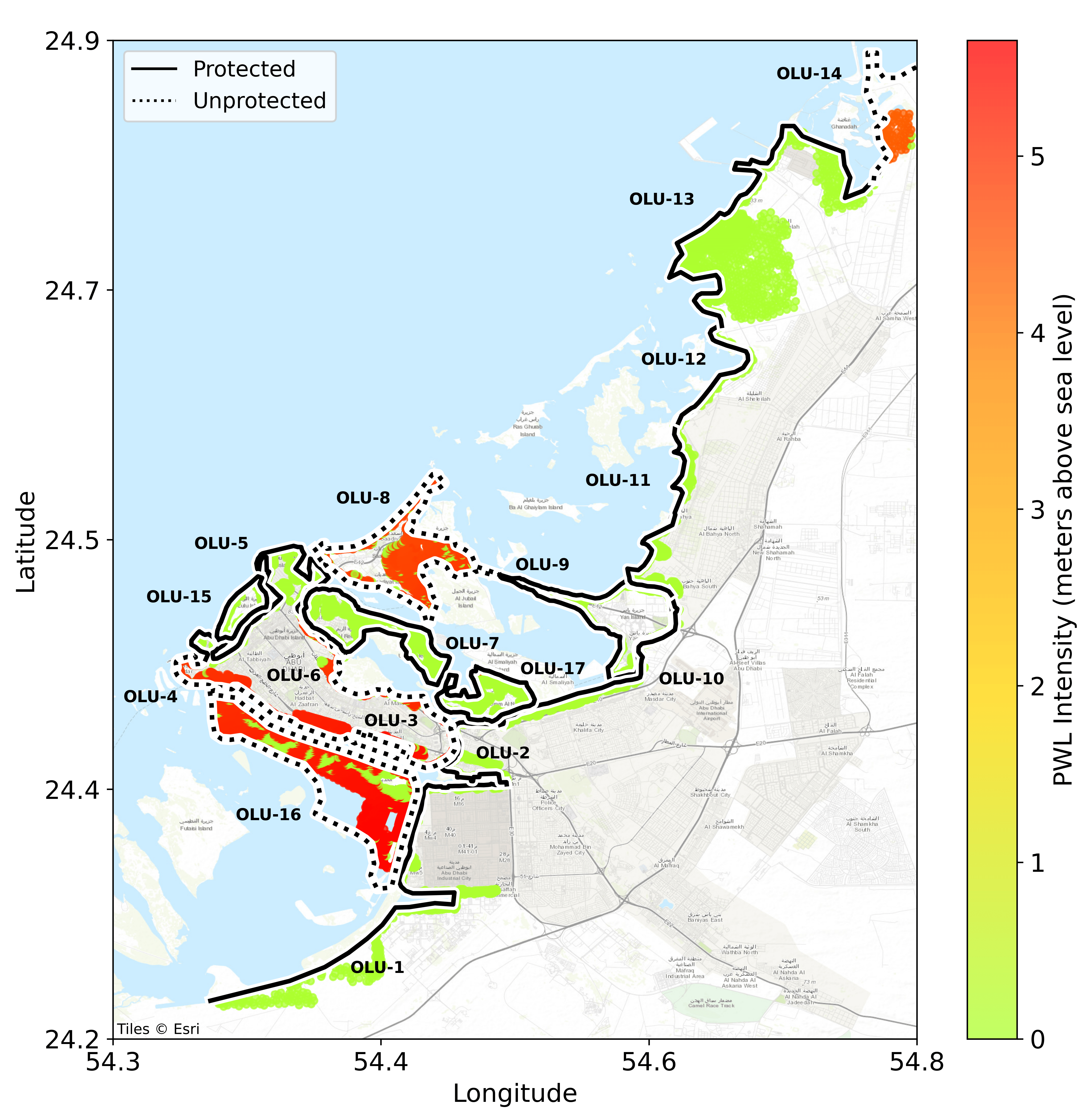
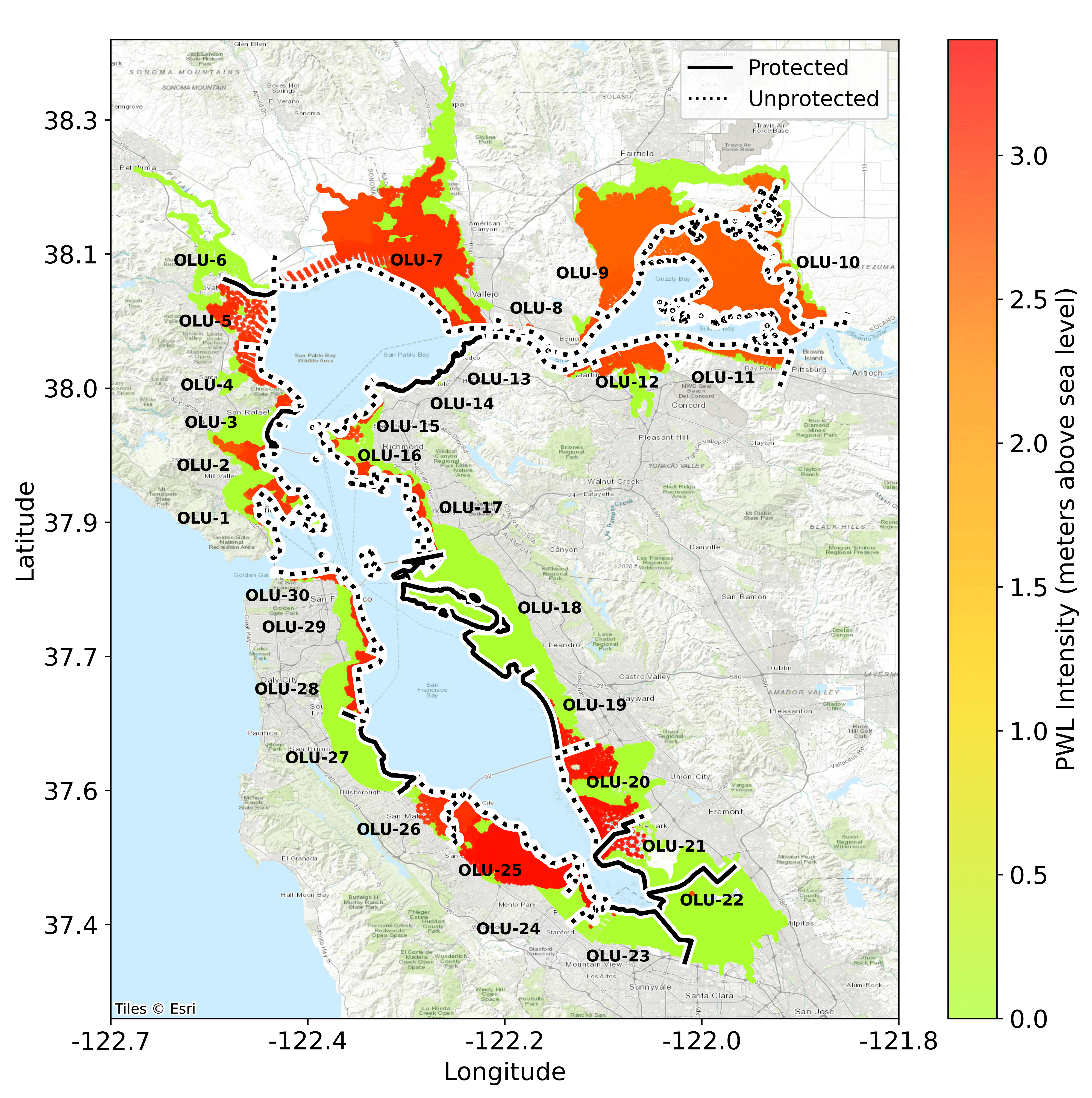
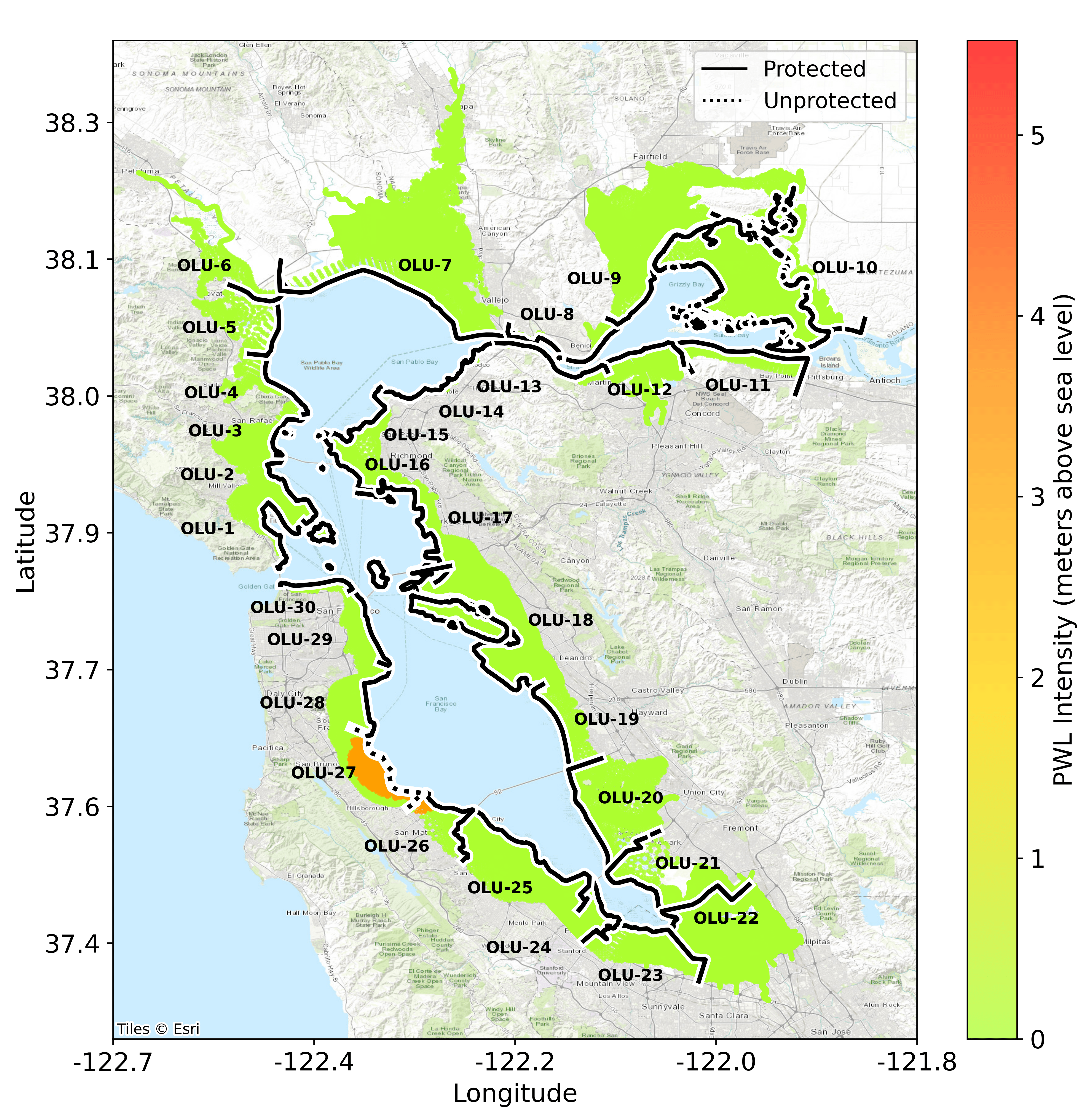
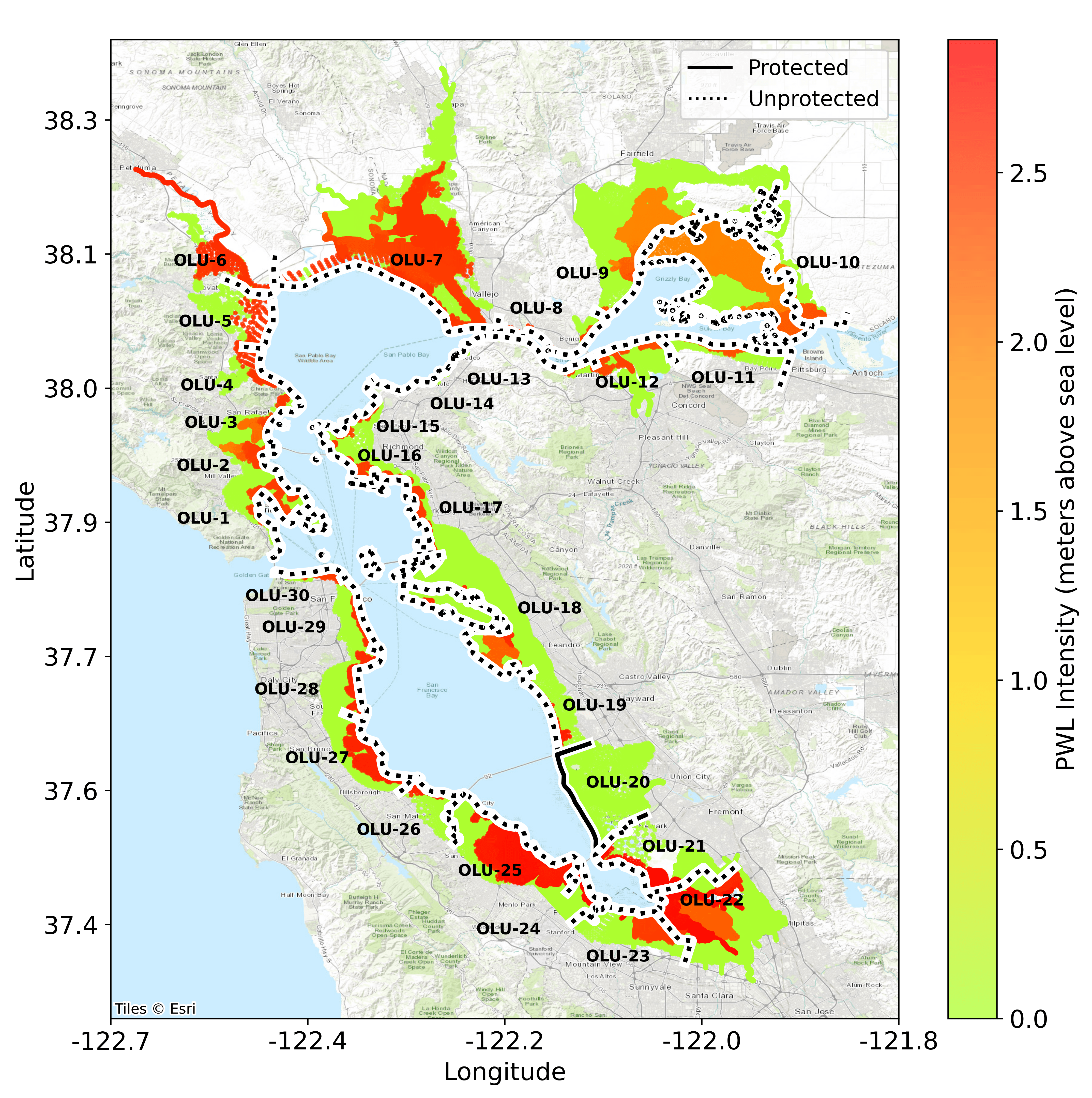
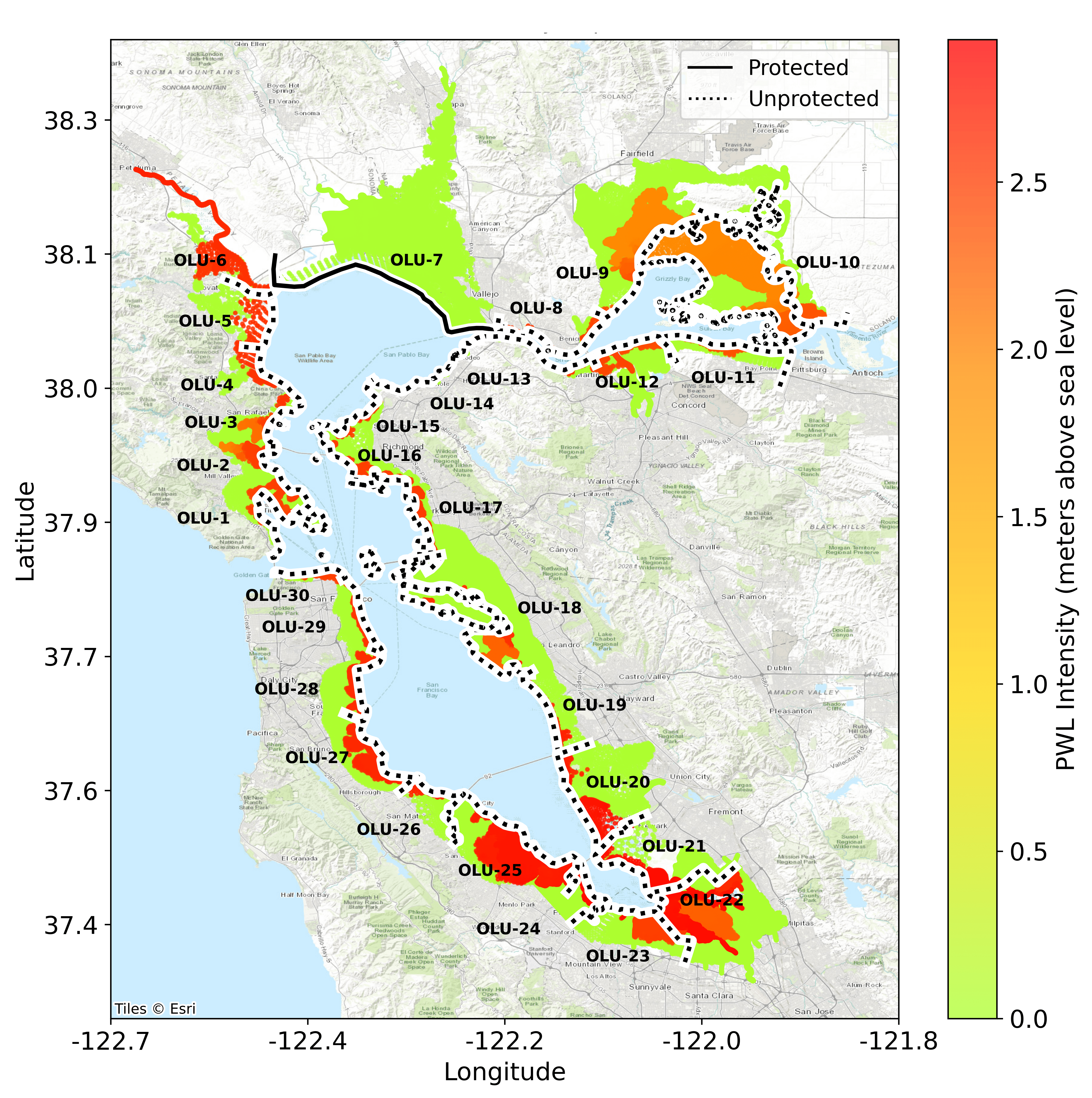
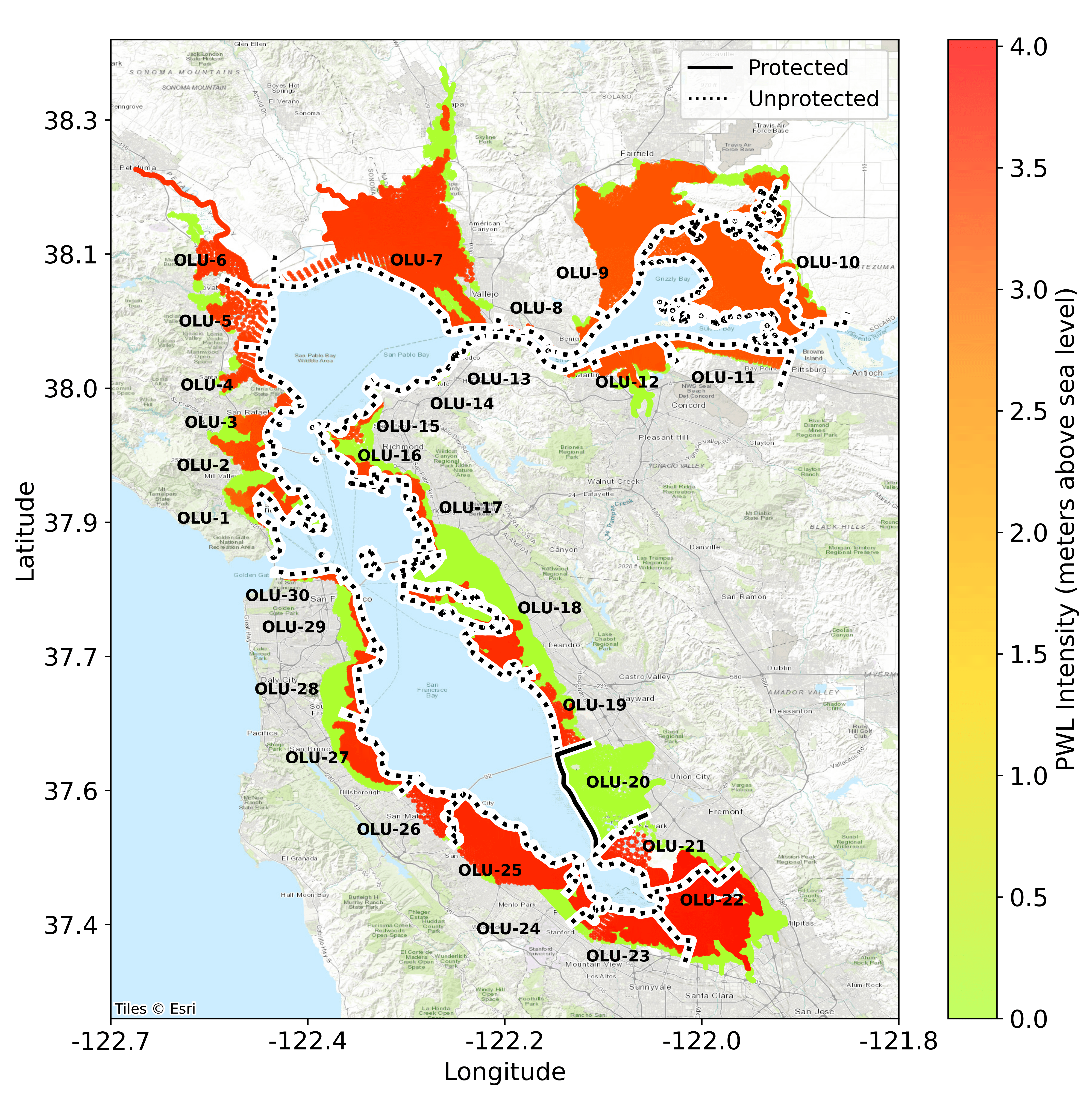
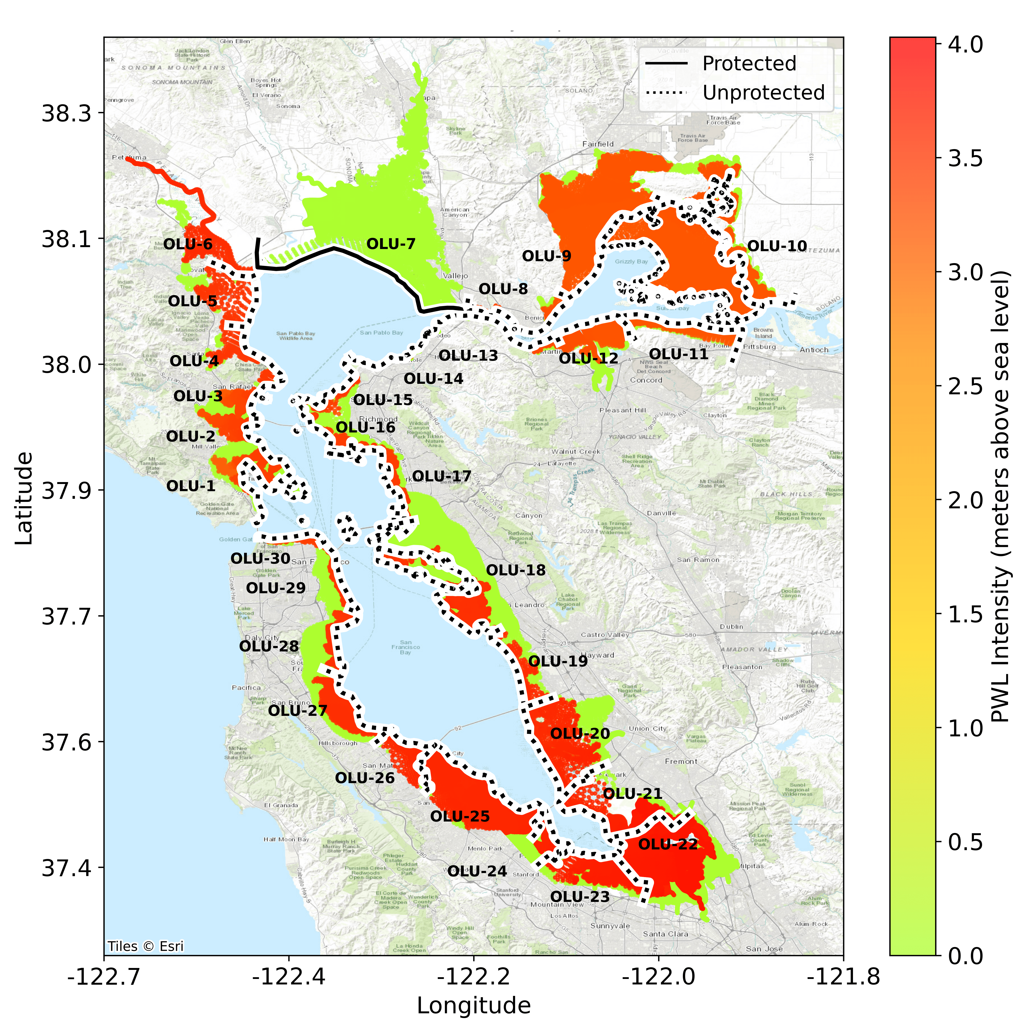
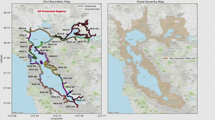
The dataset consists of flood inundation data for Abu Dhabi (AD) and San Francisco (SF) regions, covering multiple operational landscape units (OLUs) under varying SLR conditions and shoreline protection scenarios. The figure below provides an overview of these coastal regions, showing the inland inundation points for different SLR scenarios and the OLUs, which serve as coastal protection boundaries. The table below summarizes dataset details, including the number of OLUs, SLR depths, and protection scenarios in different dataset subsets.
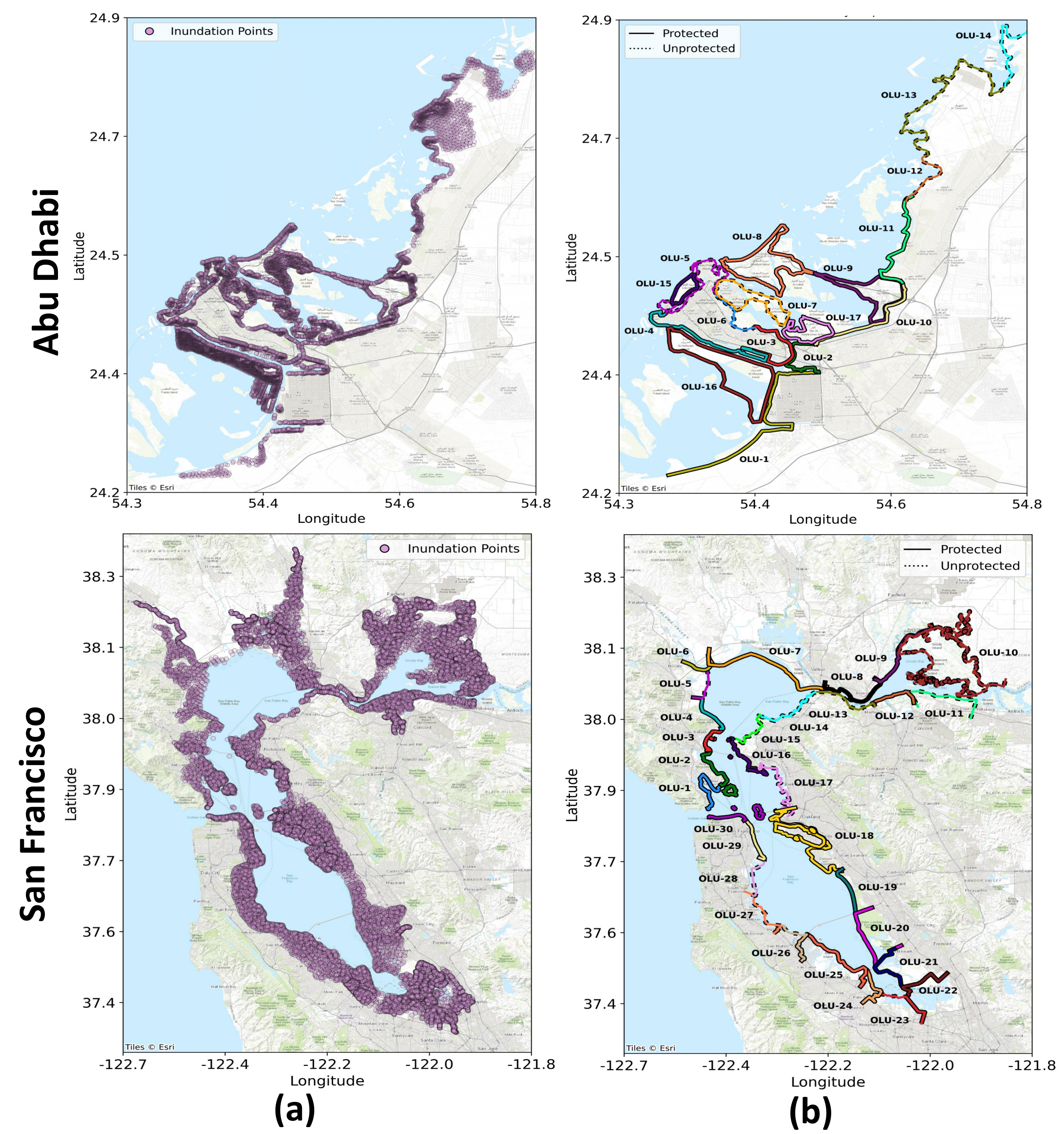
Figure: Abu Dhabi and San Francisco coastal regions. (a) Shows inland inundation points under the 0.5m SLR scenario for AD and 1.0m SLR for SF. (b) Displays the OLUs, which serve as coastal protection boundaries distinguishing protected and unprotected shorelines.
| Region | OLUs | SLR | Protection Scenarios |
|---|---|---|---|
| AD | 17 OLUs: 1 (Mussafah), 2 (Bain Al Jesrain), 3 (Grand Mosque District), 4 (AD Island West), 5 (Marina, CBD, Al Mina), 6 (AD Island East), 7 (Al Reem Island), 8 (Saadiyat Island), 9 (Yas Island), 10 (Al Raha Island), 11 (Al Shahama), 12 (Al Rahba), 13 (New Port City), 14 (Ghantoot), 15 (Lulu Island), 16 (Hudayriat Island), 17 (Inner Islands) | 0.5m | 142 (Main Set) |
| 32 (Holdout Set) | |||
| SF | 30 OLUs: 1 (Richardson), 2 (Corte Madera), 3 (San Rafael), 4 (Gallinas), 5 (Novato), 6 (Petaluma), 7 (Napa - Sonoma), 8 (Carquinez North), 9 (Suisun Slough), 10 (Montezuma Slough), 11 (Bay Point), 12 (Walnut), 13 (Carquinez South), 14 (Pinole), 15 (Wildcat), 16 (Point Richmond), 17 (East Bay Crescent), 18 (San Leandro), 19 (San Lorenzo), 20 (Alameda Creek), 21 (Mowry), 22 (Santa Clara Valley), 23 (Stevens), 24 (San Francisquito), 25 (Belmont - Redwood), 26 (San Mateo), 27 (Colma - San Bruno), 28 (Yosemite - Visitacion), 29 (Mission - Islais), 30 (Golden Gate) | 1.0m | 285 (Main Set) |
| 46 (Holdout Set) | |||
| 0.5m | 32 (Generalizability Set) | ||
| 1.5m | 32 (Generalizability Set) |
The dataset contains inland flood inundation under various shoreline protection scenarios and SLR depths.